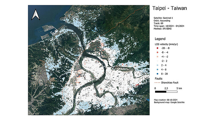
RS4Taipei: groundwater budget and subsidence risk in Taipei basin, Taiwan, from Remote Sensing and numerical modelling

| Team: | E. Rivas, M. Haghshenas Haghighi, M. Motagh |
| Jahr: | 2024 |
| Förderung: | DFG, German Research Foundation |
| Laufzeit: | Since 2024 |
Taipei is the largest city in Taiwan with a population of almost 8 million people and it is located over the Taipei basin. The basin is composed of several hundred meters of sediment layers, including four distinct aquifer layers that have been historically exploited and caused severe land subsidence deformation over this area. The RS4Taipei is a joint project with the National Taiwan University in order to study subsidence and its impact on the Taipei Basin. Several objectives have been set for this project, which include the evaluation of the groundwater change rate, establishing the relation between groundwater extraction rates and land subsidence, characterization of the aquifers based on InSAR measurements, assessing risk over infrastructures, and numerical modeling based on finite element modeling.
Project Partners:
- National Taiwan University (NTU)
- Helmholtz-Zentrum Potsdam Deutsches GeoForschungZentrum (GFZ)


