SARKI4Tagebaufolgen: Risk assessment of infrastructure damage caused by surface mining activities

| Team: | M. Motagh, M. Haghshenas Haghighi |
| Year: | 2022 |
| Funding: | Bundesministerium für Wirtschaft und Klimaschutz |
| Duration: | Since 2022 |
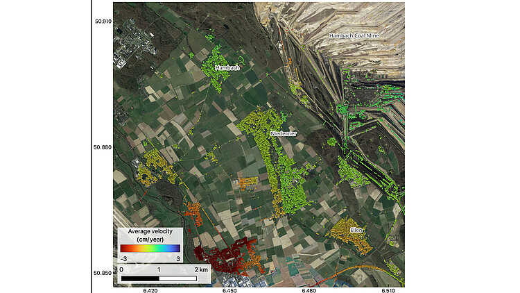
Large-scale open-pit coal mining significantly impacts the stability of infrastructure in the surrounding areas, both during active mining and after mining activities have ceased. This is mainly due to the considerable decrease in the groundwater table in mining regions, often resulting in ground instability. The SARKI4Tagebaufolgen project aims to develop a prototype model that elucidates the connections between deformation time series, geophysical environmental data, and infrastructure damage in the open pit mine area of Rhineland, western Germany. To comprehend the interaction between mining activities and urban planning, it is crucial to explore and comprehend the potential key factors. Consequently, various risk factors are examined, and the socio-economic-ecological vulnerability at different stages will be evaluated. The ultimate outcome will be a visual representation and an easily understandable interpretation of the model, which will be provided to the district administration of Düren.
Project Partners:
- Helmholtz-Zentrum Potsdam Deutsches GeoForschungsZentrum GFZ
- Kreis Düren


