Geometry
-
Invariant Descriptor learning for feature-based image matchingTeam:Jahr: 2013Förderung: China Scholarship Council (CSC); NVIDIA GPU Grant ProgramLaufzeit: since 2013
![]()
-
Time and Robustness efficient method for SFM of ordered and unordered imagesTeam:Jahr: 2016Förderung: CSC (Chinese Scholarship Council)Laufzeit: Since 2016
![]()
-
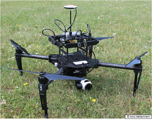
High precision trajectory determination of an UAS by integrating camera and laser scanner data with generalised object modelsTeam:Jahr: 2017Förderung: Deutsche Forschungsgemeinschaft (DFG)Laufzeit: 01.01.2017
![]()
-
Simultaneous Orientation of Images and Laser Scans from Mobile Mapping PlatformsTeam:Jahr: 2018Förderung: CSC (Chinese Scholarship Council)Laufzeit: Since 2018
![]()
-
Stereo-based pedestrian tracking and re-identificationTeam:Jahr: 2020Förderung: Deutsche Forschungsgemeinschaft (DFG)
![]()
-
High precision pose estimation of a UAV by integrating camera and laser scanner data with building modelsTeam:Jahr: 2020Förderung: Deutsche Forschungsgemeinschaft (DFG)
![]()
Photogrammetric image analysis
-
Automatic 3D reconstruction of complex cross-roads from aerial image sequences by semantic modeling of static and moving context objects (2015)Team:Jahr: 2011Förderung: Deutsche Forschungsgemeinschaft (DFG)Laufzeit: 1/2011 - 12/2013
-
Erfassung und Fortführung der Tatsächlichen Nutzung in ALKIS®Team:Jahr: 2014Laufzeit: seit 01/2013
-
Transfer learning for hierarchical Conditional Random Fields for the classification of urban aerial and satellite images (2020)Team:Jahr: 2014Förderung: DFGLaufzeit: since 2014
-
Dynamic Control Information for the relative Positioning of Nodes in a Sensor NetworkTeam:Jahr: 2016Förderung: Deutsche Forschungsgemeinschaft (DFG)Laufzeit: 01.12.2016 – 01.12.2019
![]()
-
Simultaneous contextual classification of multitemporal and multiscale remote sensing imagery based on existing GIS data for training (2020)Team:Jahr: 2016Förderung: DFGLaufzeit: since 2016
-
Pattern recognition in aerial wartime images and laser-scanning data setsTeam:Jahr: 2016Förderung: Landesamt für Geoinformation und Landesvermessung Niedersachsen (LGLN)Laufzeit: since 2016
![]()
-
Investigation and evaluation on automatic methodologies for updating and verification of geospatial databasesTeam:Jahr: 2017Förderung: LGLN¹, LVermGeo², LaiV-MV³Laufzeit: seit 2017
![]()
-
Deep Domain Adaptation for the Classification of Aerial ImagesTeam:Jahr: 2018Laufzeit: Since 2018
![]()
-
SILKNOWTeam:Jahr: 2018Förderung: EU (Horizon 2020 Programm)Laufzeit: 2018 - 2021
![]()
-
ForstCARe - Forstwirtschaftlicher Copernicus-basierter Assistenzdienst –Reduktion des Referenzdatenbedarfs und Fusion von Sensordaten zur Schließung wolkenbedingter Datenlücken für die Klassifikation mittels Künstlicher Intelligenz (KI)Team:Jahr: 2021Förderung: Bundesamt für Wirtschaft und Energie
![]()
Sonstiges
-
Interdisciplinary Center for Applied Machine Learning - ICAML (2019)Team:Jahr: 2017Förderung: Bundesministerium für Bildung und ForschungLaufzeit: 11/2017-11/2019
![]()


